Penelope Zarganis, Librarian at the British School at Athens, tells us about a project to digitise the library’s unique collection of aerial photographs of Greece…

The British School at Athens (BSA) is a post-graduate research institute for Hellenic Studies, one of the 7 British International Research Institutes sponsored by the British Academy. The School’s library and archive collections cover all aspects of research on Greece, from prehistory to the present day, in many different formats. In addition to the main library based in Athens, the School maintains a small library specialising in Cretan subjects at its research base at Knossos in Crete.The holdings of both libraries were added to Copac in February 2017.
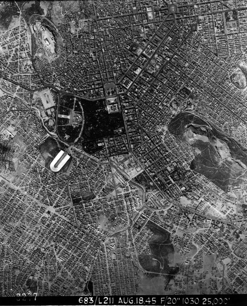
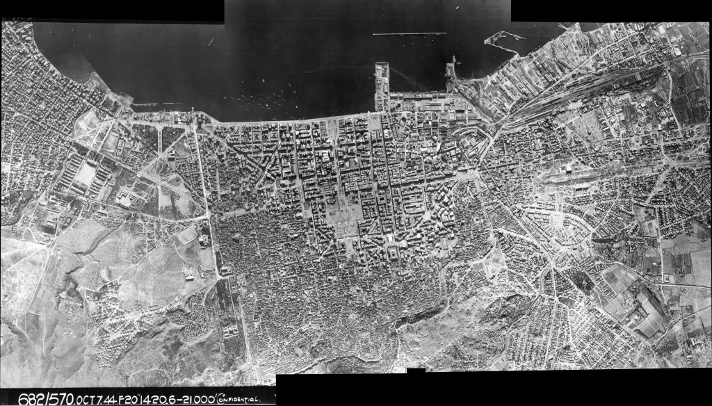
Seventy years ago the British School at Athens was given a collection of aerial reconnaissance photographs of Greece taken during the Second World War by the RAF and Allied Forces between 1943 and 1945. The collection represents approximately 750 flights, resulting in more than 30,000 individual photographs or frames, showing the topography of Greece at that time. They are of interest to archaeologists for identifying or comparing archaeological sites, to anthropologists and geographers studying changes in land use or settlement organisation, and to historians of Greece during the Second World War for topographical information on the final years of the German occupation.

Recently the BSA library received funding for a two-stage project to make this collection of aerial photographs accessible online through the BSA’s website.
Initial research revealed that the collection is unique. The negatives were not saved and this collection of prints is the only one in existence. The prints were developed under wartime conditions and are deteriorating. This meant that while making the collection accessible we also had to conserve it. The prints are mostly 21cm x 21cm with a frisket (band) at one edge giving frame number, flight squadron details, date, time, focal length and height. Each flight has been assigned a local number to aid retrieval. The prints are exceptionally clear and designed to be viewed in three dimensions using stereoscopic lenses.
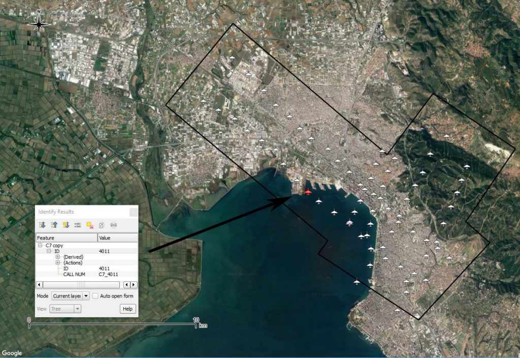
The first stage of the project, undertaken by Gian Piero Milani (Oxford University, 2017 onwards), mapped the flight paths of each run onto a digital map of Greece using GIS (geographical information system) technology. It is now possible to follow each flight in its entirety, and in the online index researchers can click on a region or sub-region to locate the individual flight paths, and identify the BSA ID number for each flight.

The second stage of the project involves digitising the prints and linking the digital images to the online index so that researchers can learn whether an aerial photograph exists for their area of interest without physically handling the fragile prints. In addition, GIS applications will enable us to enhance the geographical information associated with these images by linking them to satellite imagery.
A significant element of the project has been the use of the application QGIS to create the geo-referenced data that has been uploaded into the School’s digital management system (Axiell’s EMu), reducing the time required for creating and entering data.
This involved four stages of work:
1. Using QGIS to create data for each flight and each frame/print to be uploaded into EMu.
2. Linking this digital data record, through QGIS, to the geo-referenced flight path index on the BSA website. The standard for this level of geo-referencing was established by the National Collection of Aerial Photography (NCAP) based in Edinburgh. Each frame is indicated by a point/dot within a flight path. Selecting the dot brings up an information box about the frame/print taken from the data entered into EMu (note: this feature is not live on the BSA website at the time of writing, but will be available soon).
3. Creating a geographical index of the regions and sub-regions of Greece, using the European Nomenclature of Territorial Units for Statistics (NUTS) to standardise the place-names. Researchers are thus able to select a region to identify which flights they need.
4. Scanning each frame/print and adding it to the relevant digital data record. This image will then be added as a thumbnail to the information box in the online index (not yet completed).

Since the online index to these World War II allied reconnaissance flights was completed and made available on the British School at Athens website, interest in the collection has been impressive. The project will ultimately provide visual online access to the prints to enable researchers to identify precisely the areas photographed. It will also provide enhanced information for research citation, including source, date, and precise geo-referencing data (longitude and latitude), while preserving the collection by limiting physical access to the precious original prints.
The project is still in progress, but the index to the flights and the location index are accessible through the British School at Athens website.
For more information on the collection, contact the School’s Librarian, Penelope Wilson Zarganis.
For more information on the geo-referencing process, contact Gian Piero Milani.
Penelope Wilson Zarganis
Librarian
British School at Athens Library
Souedias 52
10676 Athens
Greece
+30 211 1022 822
library@bsa.ac.uk
www.bsa.ac.uk/index.php/departments-cat/library
All images copyright the British School at Athens, reproduced with kind permission of the copyright holder.
To browse the holdings of the British School at Athens Library, visit Copac.
Categories

